
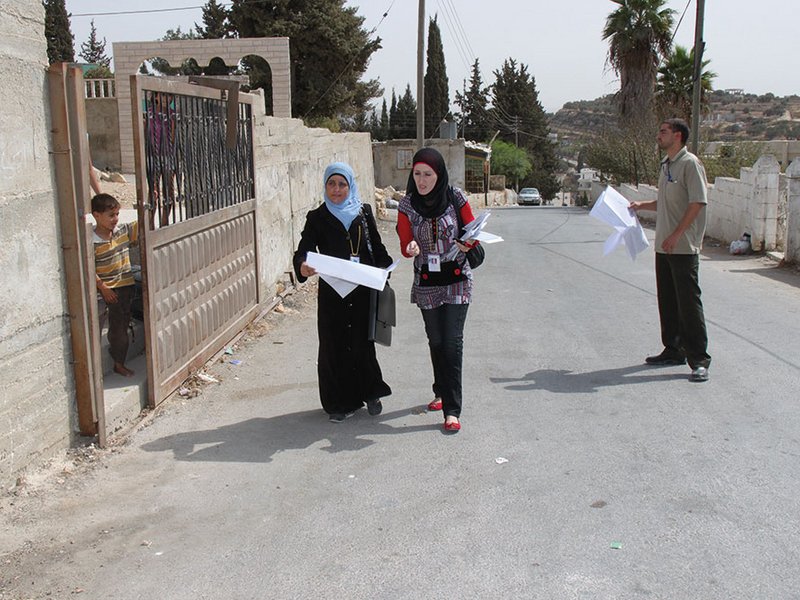
The frame of the Agricultural Census 2020 is being prepared by listing all holders through visiting every household, using maps to reach all addresses.
Photo: PCBS
 Download this article in magazine layout
- Share this article
- Subscribe to our newsletter
The Agricultural Census in Palestine
The agricultural sector has historically been an important driver in creating job opportunities in the Palestinian economy. As of 2010, this sector was employing 11.5 per cent of the Palestinian labour force, of whom 33 per cent were women. Currently the sector employs – formally and informally – an estimated amount of close to 25 per cent of the working-age population (about 760,000 people living in 146,000 households) who rely on farming, livestock rearing, fishing activities and processing. Agricultural products account for about one quarter of Palestinian exports. Around 70 per cent of the agricultural production takes place in the West Bank and 30 per cent in the Gaza Strip (see Box).
Palestine’s agricultural sector
The agricultural land covers more than 120,000 ha that is cultivated with all kinds of vegetables and field crops, in addition to the groves of fruit trees and to rangeland. The Palestinian agriculture sector is characterised by its diversity. It would benefit from the climatic variations and reap existing opportunities for expanding irrigated and export cash crops if it was able to make full use of agricultural innovation and the presence of agricultural entrepreneurs. However, mainly due to the impact of Israeli Occupation, the sector growth has been severely restricted.
Palestine comprises five agro-ecological zones. The coastal plain zone (Gaza Strip) extends from the North to South on the south-eastern shores of the Mediterranean Sea and is dubbed the “fish basket” of Palestine. The semi-coastal zone – i.e. the north-western corner of the West Bank, which includes the governorates of Jenin, Tulkarem and Qalqiliah – measures the highest annual rainfall. The middle elevation zone ranges from Jenin in the North to Hebron in the South. The steppe zone that extends from Eastern Jenin to the Dead Sea in the South is considered as rangeland, and the fifth zone is located in the Western Jordan Valley.
Agricultural holdings in Palestine are with an average size of 1.86 ha, the majority (88 %) are owned outright by the household. As of 2010, there are 101,172 holdings in Palestine, nearly 70 per cent of which are plant production holdings and 7.6 per cent are livestock holdings, with the remainder comprising diverse production. The sector is a mix of commercial and subsistence farming, which includes farming as a sideline economic activity of many households particularly in the semi-coastal zone with rain-fed agriculture. Most of irrigated farmland is located in the Jordan Valley and the Gaza Strip, while fields in the highlands have hardly any irrigation systems because of climate conditions. The use of machinery is basic, given the nature of the topography in Palestine – much of the work is done manually and is labour-intensive.
Rainfall patterns cause plant production to vary from year to year and it has not experienced significant changes over the last decade. Neither have any major changes occurred in terms of the relative distribution of varieties of different crops, which is characterised in general – and especially in the West Bank – by relatively low value crops and the low percentage of irrigated agricultural areas. Olive tree cultivation covers the largest agricultural area in the West Bank, occupying approximately 57 per cent of cultivated land, while crops, vegetables and other fruit trees account for the remaining area, at 24 per cent, ten per cent and almost nine per cent respectively. In the Gaza Strip, vegetable crops constitute 32 per cent of the total cultivated area, followed by olive trees (24 %) and other field crops (23 %) and fruit trees (21 %).
Since current data on the agricultural situation is not up to date and does not reflect the real situation on the ground, an agricultural census is being carried out. Its results will serve as a base for strategic planning and policy-making. Harmonised with Palestinian national requirements and international standards, the Palestinian Central Bureau of Statistics (PCBS) has striven to collect and disseminate official statistics. In cooperation with the Ministry of Agriculture and the Union of Agricultural Work Committees, PCBS implemented the first census on agriculture in 2010. The Agricultural Census 2020 is conducted by PCBS together with the Ministry of Agriculture (MOA) and supported, among other development partners, by the Swiss Agency for Development and Cooperation (SDC).
In the context of Palestine under Israeli Occupation since 1967, all economic sectors have been subject to policies and constraints that impede sustainable development. The agriculture sector has been particularly affected by the confiscation of large areas of land and by loss of access to land, water resources and irrigation development for farmers and herders. The full closure (by land, sea and air) of the Gaza Strip since 2007 and the intra-Palestinian political divide have also heavily contributed to increasing constraints on the agriculture sector.
Why a census, for whom and how?
According to the United Nations Food and Agriculture Organization (FAO), the census of agriculture is one of the key pillars of a national statistical system. The FAO is providing guidelines for its conduct that are utilised for the preparation of the Agriculture Census 2020 in Palestine.
The Agricultural Census shall facilitate future comparisons with neighbouring countries and shall provide data on the structure of the sector as basis for projecting related indicators to optimise the use of agricultural resources and thus contributing to food security and self-reliance. In addition, data will build a sampling frame for future surveys. Such data are the backbone for regional planning, better distribution of resources and meeting the needs of the private sector. These statistics are necessary for the planning and monitoring of agriculture-related programmes by governmental and private institutions. Furthermore, the Agricultural Census will monitor the changes affecting agricultural land as a result of continuous Israeli Occupation, confiscation of land, marginalisation and isolation of the Palestinian population and the building of the Separation Wall. Given important and continuous changes in this regard, an updated census is highly desired and required.
Since agricultural censuses are usually undertaken only every ten years, it is natural to associate them with those aspects of agriculture that change relatively slowly over time. Thus, agricultural censuses are mainly concerned with data on the basic organisational structure of agricultural holdings, such as the size of a holding, land tenure, land use, crop area, irrigation, livestock numbers, labour, use of machinery and other agricultural inputs. Agricultural censuses have not normally included data that change from year to year, such as agricultural production or agricultural prices. The census’ final results will comprise the number of agricultural holdings classified by type (plant, animal, or mixed), the area of cultivated land, the number of domestic livestock (cows, goats, sheep, poultry, camels, rabbits, etc.), the agricultural labour force and its distribution according to sex and age, the number of agricultural machinery and equipment as well as agricultural applications.
The Agricultural Census 2010 was not built in a way to accommodate sector development and to follow up on its effective or potential growth. Drawing from this experience, the MOA and PCBS planned the upcoming census with sustainability as its core. It is therefore envisaged to establish an effective agricultural registry to decrease the reliance on expensive decennial censuses. The design and purpose of the Agricultural Census 2020 fits under the national strategies to ensure proper prioritisation, planning, budgeting and decision-making by public and private stakeholders.
However, in the occupied Palestinian territory, data related to agricultural holdings may be irremediably altered by land confiscation operated by Israeli authorities for infrastructure (by-pass roads, security fences, etc.) aimed to serve – in priority or in exclusivity – the increasing population of settlers living in the West Bank. Moreover, the building of the Separation Wall between Israel proper and the West Bank, the existence of which was declared unlawful back in 2004 by an advisory opinion of the International Court of Justice, has cut off 150 Palestinian rural communities from their agricultural or pastureland, water resources and public infrastructure.
Supporting the Agricultural Census 2020
The Swiss Cooperation Office Gaza and West Bank in Jerusalem helps to strengthen the economic viability of the agricultural sector in the occupied Palestinian Territory. Starting in 2018, the objective of this support is to “establish an updated detailed and accurate holdings database that will assist in planning and policy-making at all levels related to the agricultural sector”. By 2021, data on the structure of agriculture, especially for small administrative and geographical units, rare items and detailed cross-tabulations will have been produced. Primary users of the census will be the MOA, farmers’ unions, agricultural cooperative societies and individual Palestinian private sector investors. Universities, research institutions, NGOs as well as bilateral and multilateral development agencies will also use updated data.
From theory to practice
The data collection of agricultural holdings within a specified period in a specific region is called the enumeration period. The statistical unit is the agricultural holding. The frame of the Agricultural Census 2020 will cover holdings by households and collaborative institutions. The frame is being prepared by listing all holders through visiting every household, using maps to reach all addresses. The census will cover the entire occupied Palestinian Territory, including rural and urban areas and refugee camps.
The census is conducted in three stages: the preparatory stage, the field work stage and the data processing and dissemination stage. The preparatory stage comprises the formation of organisational structures and the agricultural census committees. Consultations are being held with relevant stakeholders and data users to agree on priorities on the census contents. A pilot census will be conducted to draw up a final version of the census manuals, prepare the implementation plans and data processing mechanisms, estimate the number of census personnel required, etc., in parallel to listing agricultural holders and holdings. The borders of enumeration area maps will be updated during the field work. The data processing and dissemination stage includes collecting the questionnaires, editing, coding and entering the booklets and questionnaires, in addition to tabulating and disseminating the preliminary and final results.
The planned census will help us – at the ministry – to plan interventions where needed and to identify gaps in the supply chain for national needs. It will also provide essential data to ensure proper management of the sector for the benefit of the farmers and the citizens of the state of Palestine.
Abdallah Lahlouh, Deputy Minister of Agriculture, Palestine
Two questionnaires will be designed; the first will list households and agricultural holdings, while the second is related to the enumeration of the agricultural holdings. Items and variables are data of households and agricultural holdings, in addition to identification data, building name or owner, type of building and its current use, number of household members (males, females), educational level, the holding management method and main purpose of production amongst others. After having finished the data collection, the processing will start. Data processing includes all activities after the field work, such as editing of questionnaires, coding, data entry and computer editing. The technical team will follow up the data processing, testing its accuracy and quality and comparing it with the preliminary results and other data resources, in addition to preparing final results of the census.
Coping with specific challenges
Challenges arising in collecting data in this context are manifold and unique, ranging between political and security issues to limited infrastructure. Digitisation and ICT tools in particular usually provide solutions to overcome practical problems, but their use is restricted by Israeli regulations. The MOA and PCBS will use innovative paperless technologies to collect data from the West Bank and the Gaza Strip. They will also use particularly developed tablet applications to gain access to difficult-to-reach areas and farmers, especially in the Jordan Valley and in the Gaza Strip. Overall, these difficult-to-reach areas comprise the majority of agricultural land in the occupied Palestinian Territory.
Getting access to the Gaza Strip is another challenge for PCBS staff, one that they decided to mitigate through relying on electronic transmission of data between the Gaza Strip and the West Bank for analysis. Even in this case, PCBS faces the likelihood of power shortages endangering data integrity that must be met with the provision of sufficient fuel for autonomous energy generation. Another set of constraints are laid by Israel’s prohibition of the use of unmanned aerial vehicles – commonly known as drones – to collect agricultural data. Indeed, using drones would have provided access and coverage of large swathes of agricultural land, substantially lowering the overall costs of the census.
Despite its dire financial situation, the Palestinian Authority allocated four million US dollars to the Agriculture Census 2020. This amount represents half of its total cost. While the European Union and the Spanish Agency for International Development Cooperation joined Switzerland as co-financing partners, an important financial gap remains (estimated at three million US dollars at mid- 2019), which threatens the implementation and sustainability of this strategic endeavour. Swiss funding combined the provision of financial contributions and technical assistance through the Swiss Federal Office of Statistics to equip MOA and PCBS with up-to-date knowledge and expertise.
Summing up…
In addition to the immediate gains of the Agricultural Census 2020 for decision-makers, farmers and investors in terms of available relevant data, the building of an agriculture registry in Palestine will be a key contribution to continuous improvement in the sector and to sustainability. The structure of the agriculture registry will be holders-based. Farmers will have individual protected access to their own specific information that they can update.
The information will be fed into different layers that provide users with the overall picture and related statistics. The registry will be hosted by the MOA with an interface to the GIS system hosted by the Ministry of Local Government, with visual representation through produced maps.
The availability of up-to-date data will allow public and private sector operators to perform the analysis needed for decision-making. The private sector can benefit in terms of identifying appropriate areas of investment, while the ministries and civil society can develop their priorities with regard to policies and/or actions to improve overall sector performance.
Ayman Daraghmeh is Senior Programme Manager at SDC in Palestine.
Contact: ayman.daraghmeh@eda.admin.ch
Hasan Ashqar is the Director General of Planning and Policies at the Ministry of Agriculture in Palestine.
Contact: hasan.ashqar@moa.pna.ps
References:
Palestinian Central Bureau of Statistics (2011). Agricultural Census 2010, Final Results –
Palestinian Territory. Ramallah, Palestine.
Palestinian Ministry of Agriculture (2016). National Agricultural Sector Strategy (2017-2022) “Resilience and Sustainable Development”
News Comments
Current Print Issue


Add a comment
Comments :